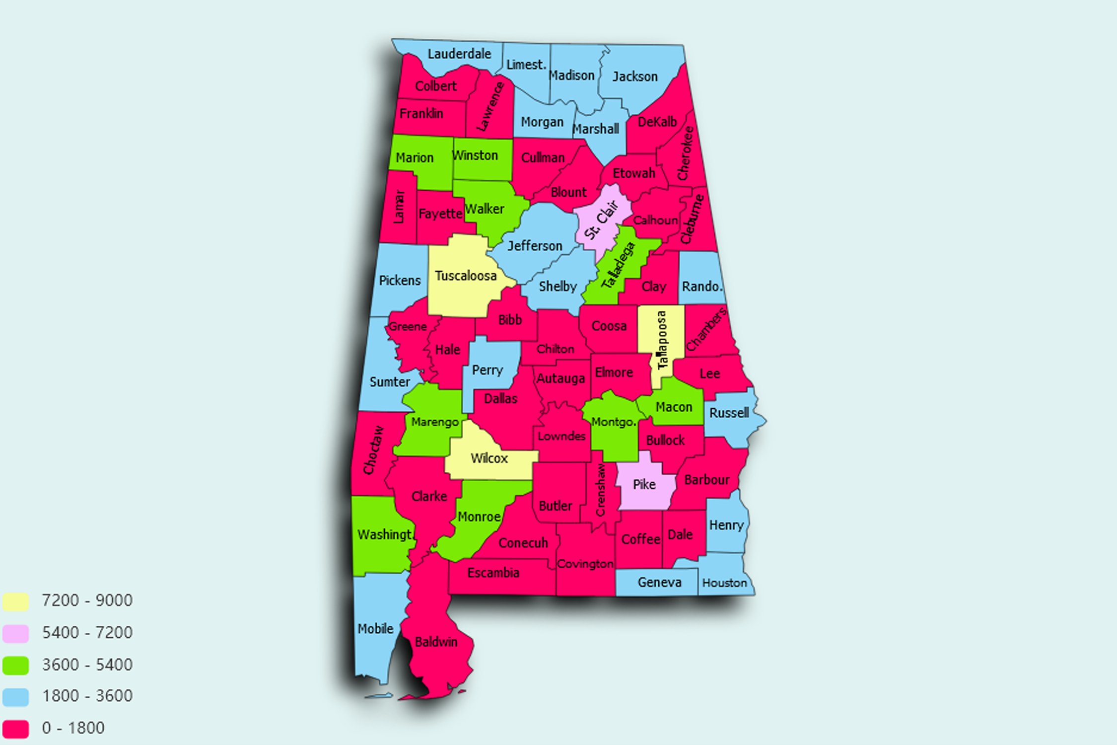
Alabama State Statistics
About: Find out about your mental health and make a difference to everyday in your life.
![]() Population: 212247
Population: 212247
![]() Population: 200481
Population: 200481
![]() Population: 194675
Population: 194675
![]() Population: 188226
Population: 188226
![]() Population: 96122
Population: 96122
![]() Population: 84353
Population: 84353
![]() Population: 68409
Population: 68409
![]() Population: 60258
Population: 60258
![]() Population: 60211
Population: 60211
![]() Population: 55532
Population: 55532
![]() Population: 46450
Population: 46450
![]() Population: 40215
Population: 40215
![]() Population: 37540
Population: 37540
![]() Population: 36295
Population: 36295
![]() Population: 35317
Population: 35317
![]() Population: 34124
Population: 34124
![]() Population: 33064
Population: 33064
![]() Population: 31545
Population: 31545
![]() Population: 29351
Population: 29351
![]() Population: 29171
Population: 29171
![]() Population: 27772
Population: 27772
![]() Population: 26949
Population: 26949
![]() Population: 25802
Population: 25802
![]() Population: 24709
Population: 24709
![]() Population: 24633
Population: 24633
![]() Population: 24522
Population: 24522
![]() Population: 24395
Population: 24395
![]() Population: 22699
Population: 22699
![]() Population: 22457
Population: 22457
![]() Population: 22312
Population: 22312
![]() Population: 21458
Population: 21458
![]() Population: 21155
Population: 21155
![]() Population: 20734
Population: 20734
![]() Population: 20702
Population: 20702
![]() Population: 19814
Population: 19814
![]() Population: 19138
Population: 19138
![]() Population: 18089
Population: 18089
![]() Population: 17883
Population: 17883
![]() Population: 17710
Population: 17710
![]() Population: 17398
Population: 17398
![]() Population: 16777
Population: 16777
![]() Population: 16243
Population: 16243
![]() Population: 16012
Population: 16012
![]() Population: 15815
Population: 15815
![]() Population: 15169
Population: 15169
![]() Population: 15145
Population: 15145
![]() Population: 14849
Population: 14849
![]() Population: 14748
Population: 14748
![]() Population: 14700
Population: 14700
![]() Population: 14459
Population: 14459
![]() Population: 14409
Population: 14409
![]() Population: 14125
Population: 14125
![]() Population: 14109
Population: 14109
![]() Population: 14096
Population: 14096
![]() Population: 13744
Population: 13744
![]() Population: 13729
Population: 13729
![]() Population: 13614
Population: 13614
![]() Population: 13573
Population: 13573
![]() Population: 13528
Population: 13528
![]() Population: 12972
Population: 12972
![]() Population: 12781
Population: 12781
![]() Population: 12703
Population: 12703
![]() Population: 12457
Population: 12457
![]() Population: 12444
Population: 12444
![]() Population: 12250
Population: 12250
![]() Population: 11939
Population: 11939
![]() Population: 11758
Population: 11758
![]() Population: 11175
Population: 11175
![]() Population: 11091
Population: 11091
![]() Population: 10988
Population: 10988
![]() Population: 10963
Population: 10963
![]() Population: 10779
Population: 10779
![]() Population: 10744
Population: 10744
![]() Population: 10469
Population: 10469
![]() Population: 10325
Population: 10325
![]() Population: 10162
Population: 10162
![]() Population: 10006
Population: 10006
![]() Population: 9806
Population: 9806
![]() Population: 9700
Population: 9700
![]() Population: 9689
Population: 9689
![]() Population: 9606
Population: 9606
![]() Population: 9453
Population: 9453
![]() Population: 9144
Population: 9144
![]() Population: 9081
Population: 9081
![]() Population: 9055
Population: 9055
![]() Population: 9049
Population: 9049
![]() Population: 9008
Population: 9008
![]() Population: 8993
Population: 8993
![]() Population: 8913
Population: 8913
![]() Population: 8908
Population: 8908
![]() Population: 8894
Population: 8894
![]() Population: 8769
Population: 8769
![]() Population: 8727
Population: 8727
![]() Population: 8552
Population: 8552
![]() Population: 8529
Population: 8529
![]() Population: 8517
Population: 8517
![]() Population: 8358
Population: 8358
![]() Population: 8284
Population: 8284
![]() Population: 7933
Population: 7933
![]() Population: 7902
Population: 7902
![]() Population: 7806
Population: 7806
![]() Population: 7661
Population: 7661
![]() Population: 7599
Population: 7599
![]() Population: 7557
Population: 7557
![]() Population: 7362
Population: 7362
![]() Population: 7259
Population: 7259
![]() Population: 7182
Population: 7182
![]() Population: 7143
Population: 7143
![]() Population: 6843
Population: 6843
![]() Population: 6790
Population: 6790
![]() Population: 6746
Population: 6746
![]() Population: 6677
Population: 6677
![]() Population: 6627
Population: 6627
![]() Population: 6601
Population: 6601
![]() Population: 6447
Population: 6447
![]() Population: 6438
Population: 6438
![]() Population: 6257
Population: 6257
![]() Population: 6242
Population: 6242
![]() Population: 6209
Population: 6209
![]() Population: 6189
Population: 6189
![]() Population: 6187
Population: 6187
![]() Population: 6167
Population: 6167
![]() Population: 6130
Population: 6130
![]() Population: 6081
Population: 6081
![]() Population: 6021
Population: 6021
![]() Population: 5981
Population: 5981
![]() Population: 5970
Population: 5970
![]() Population: 5963
Population: 5963
![]() Population: 5940
Population: 5940
![]() Population: 5808
Population: 5808
![]() Population: 5788
Population: 5788
![]() Population: 5773
Population: 5773
![]() Population: 5743
Population: 5743
![]() Population: 5736
Population: 5736
![]() Population: 5729
Population: 5729
![]() Population: 5692
Population: 5692
![]() Population: 5682
Population: 5682
![]() Population: 5625
Population: 5625
![]() Population: 5611
Population: 5611
![]() Population: 5554
Population: 5554
![]() Population: 5456
Population: 5456
![]() Population: 5391
Population: 5391
![]() Population: 5281
Population: 5281
![]() Population: 5263
Population: 5263
![]() Population: 5258
Population: 5258
![]() Population: 5251
Population: 5251
![]() Population: 5197
Population: 5197
![]() Population: 5174
Population: 5174
![]() Population: 5142
Population: 5142
![]() Population: 5122
Population: 5122
![]() Population: 5105
Population: 5105
![]() Population: 5086
Population: 5086
![]() Population: 5079
Population: 5079
![]() Population: 5068
Population: 5068
![]() Population: 5032
Population: 5032
![]() Population: 5025
Population: 5025
![]() Population: 5011
Population: 5011
Alabama State, constituent state of the United States of America, admitted to the union in 1819 as the 22nd state. Alabama forms a roughly rectangular shape on the map, elongated in a north-south direction. It is bordered by Tennessee to the north, Georgia to the east, and Mississippi to the west. .

About: Find out about your mental health and make a difference to everyday in your life.