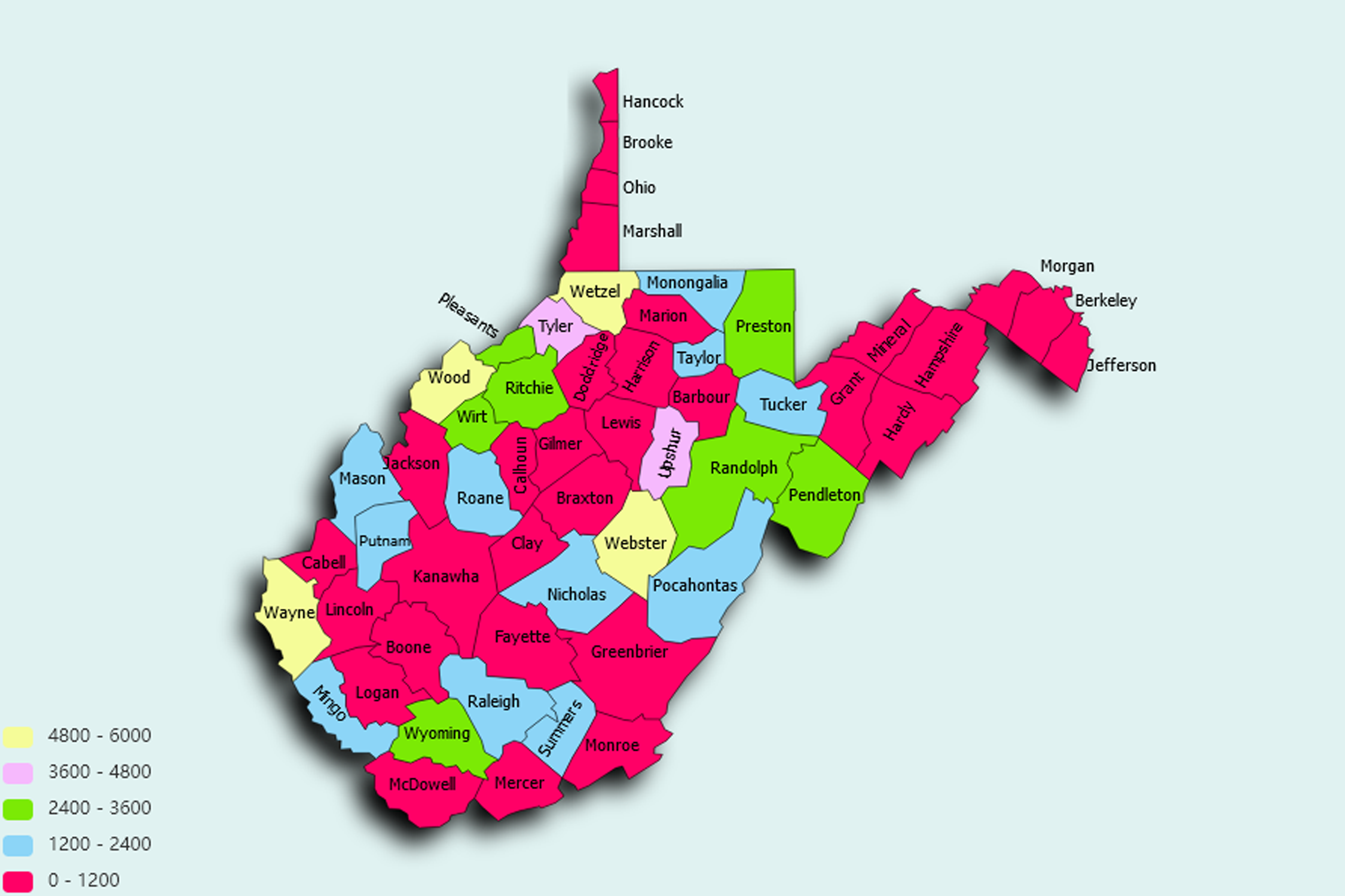
West Virginia State Statistics
About: Marbles; most of the country's glass marbles made around Parkersburg
![]() Population: 50404
Population: 50404
![]() Population: 48807
Population: 48807
![]() Population: 31073
Population: 31073
![]() Population: 30981
Population: 30981
![]() Population: 27790
Population: 27790
![]() Population: 19362
Population: 19362
![]() Population: 18740
Population: 18740
![]() Population: 18006
Population: 18006
![]() Population: 17743
Population: 17743
![]() Population: 17238
Population: 17238
![]() Population: 16242
Population: 16242
![]() Population: 13214
Population: 13214
![]() Population: 13175
Population: 13175
![]() Population: 12110
Population: 12110
![]() Population: 10835
Population: 10835
![]() Population: 10562
Population: 10562
![]() Population: 10448
Population: 10448
![]() Population: 10445
Population: 10445
![]() Population: 9995
Population: 9995
![]() Population: 8891
Population: 8891
![]() Population: 8358
Population: 8358
![]() Population: 8175
Population: 8175
![]() Population: 7988
Population: 7988
![]() Population: 7749
Population: 7749
![]() Population: 7286
Population: 7286
![]() Population: 6837
Population: 6837
![]() Population: 6650
Population: 6650
![]() Population: 6396
Population: 6396
![]() Population: 6359
Population: 6359
![]() Population: 5706
Population: 5706
![]() Population: 5679
Population: 5679
![]() Population: 5264
Population: 5264
![]() Population: 5254
Population: 5254
![]() Population: 5199
Population: 5199
![]() Population: 5171
Population: 5171
West Virginia State, constituent state of the United States of America. Admitted to the union as the 35th state in 1863, it is a relatively small state. It is bordered by Pennsylvania to the north, Maryland and Virginia to the east, Kentucky to the southwest, and Ohio to the northwest. The state capital is Charleston. West Virginia justifies in every way its nickname, the Mountain State. With an average elevation of about 1,500 feet (460 metres) above sea level, it is the highest of any U.S. state east of the Mississippi River.

About: Marbles; most of the country's glass marbles made around Parkersburg