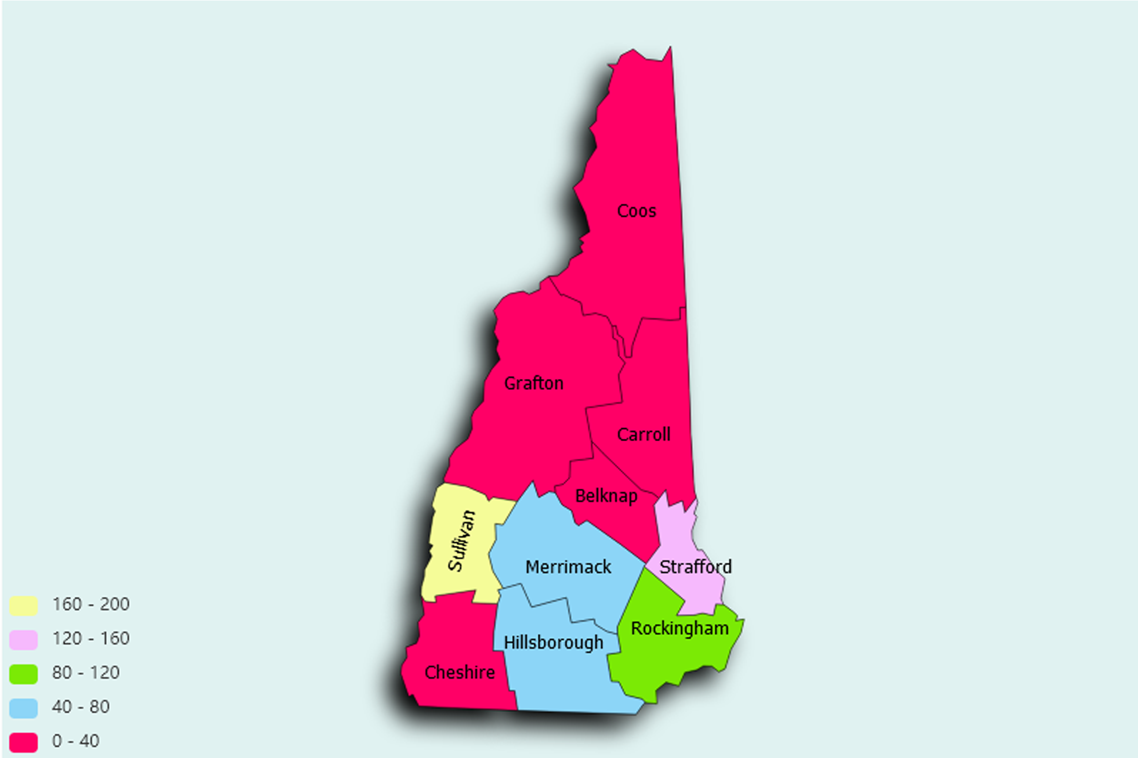
New Hampshire State Statistics
About: Artificial rain, first used near Concord in 1947 to fight a forest fire
![]() Population: 110448
Population: 110448
![]() Population: 87259
Population: 87259
![]() Population: 42444
Population: 42444
![]() Population: 30665
Population: 30665
![]() Population: 29991
Population: 29991
![]() Population: 28776
Population: 28776
![]() Population: 25494
Population: 25494
![]() Population: 23034
Population: 23034
![]() Population: 22015
Population: 22015
![]() Population: 21598
Population: 21598
![]() Population: 21203
Population: 21203
![]() Population: 17651
Population: 17651
![]() Population: 16067
Population: 16067
![]() Population: 13592
Population: 13592
![]() Population: 13589
Population: 13589
![]() Population: 13074
Population: 13074
![]() Population: 12897
Population: 12897
![]() Population: 11777
Population: 11777
![]() Population: 11201
Population: 11201
![]() Population: 11037
Population: 11037
![]() Population: 10345
Population: 10345
![]() Population: 9656
Population: 9656
![]() Population: 9501
Population: 9501
![]() Population: 9242
Population: 9242
![]() Population: 8835
Population: 8835
![]() Population: 8785
Population: 8785
![]() Population: 8693
Population: 8693
![]() Population: 8636
Population: 8636
![]() Population: 8576
Population: 8576
![]() Population: 8523
Population: 8523
![]() Population: 8428
Population: 8428
![]() Population: 8271
Population: 8271
![]() Population: 7684
Population: 7684
![]() Population: 7609
Population: 7609
![]() Population: 7519
Population: 7519
![]() Population: 7356
Population: 7356
![]() Population: 7336
Population: 7336
![]() Population: 7255
Population: 7255
![]() Population: 7230
Population: 7230
![]() Population: 7126
Population: 7126
![]() Population: 7115
Population: 7115
![]() Population: 6751
Population: 6751
![]() Population: 6025
Population: 6025
![]() Population: 6014
Population: 6014
![]() Population: 5986
Population: 5986
![]() Population: 5589
Population: 5589
![]() Population: 5418
Population: 5418
![]() Population: 5379
Population: 5379
![]() Population: 5321
Population: 5321
![]() Population: 5317
Population: 5317
![]() Population: 5298
Population: 5298
![]() Population: 5297
Population: 5297
![]() Population: 5250
Population: 5250
![]() Population: 5099
Population: 5099
![]() Population: 5078
Population: 5078
New Hampshire State, constituent state of the United States of America. One of the 13 original U.S. states, it is located in New England at the extreme northeastern corner of the country. It is bounded to the north by the Canadian province of Quebec, to the east by Maine and a 16-mile (25-km) stretch of the Atlantic Ocean, to the south by Massachusetts, and to the west by Vermont. The capital is Concord, located in the south-central part of the state.

About: Artificial rain, first used near Concord in 1947 to fight a forest fire