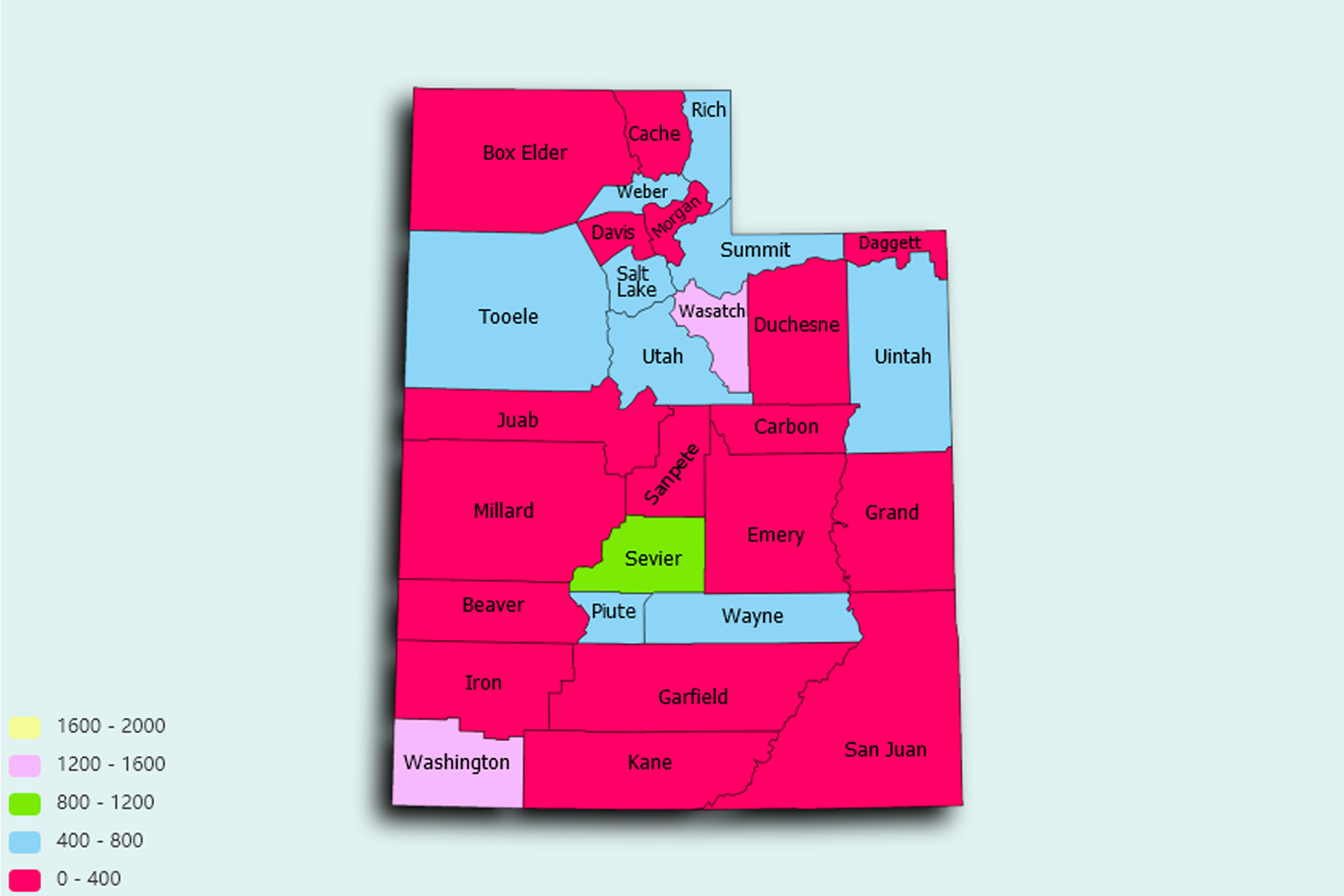
Utah State Statistics
About: Rainbow Bridge, the largest natural stone bridge in the world, 290 feet high, 275 feet across
![]() Population: 190884
Population: 190884
![]() Population: 179550
Population: 179550
![]() Population: 134495
Population: 134495
![]() Population: 114801
Population: 114801
![]() Population: 110920
Population: 110920
![]() Population: 106781
Population: 106781
![]() Population: 91781
Population: 91781
![]() Population: 91148
Population: 91148
![]() Population: 84316
Population: 84316
![]() Population: 78505
Population: 78505
![]() Population: 72231
Population: 72231
![]() Population: 62781
Population: 62781
![]() Population: 62139
Population: 62139
![]() Population: 60433
Population: 60433
![]() Population: 56275
Population: 56275
![]() Population: 48997
Population: 48997
![]() Population: 48822
Population: 48822
![]() Population: 46202
Population: 46202
![]() Population: 43385
Population: 43385
![]() Population: 41457
Population: 41457
![]() Population: 37877
Population: 37877
![]() Population: 37527
Population: 37527
![]() Population: 37064
Population: 37064
![]() Population: 35731
Population: 35731
![]() Population: 34166
Population: 34166
![]() Population: 32573
Population: 32573
![]() Population: 31725
Population: 31725
![]() Population: 31464
Population: 31464
![]() Population: 30484
Population: 30484
![]() Population: 29494
Population: 29494
![]() Population: 29483
Population: 29483
![]() Population: 28556
Population: 28556
![]() Population: 27129
Population: 27129
![]() Population: 26639
Population: 26639
![]() Population: 26505
Population: 26505
![]() Population: 25593
Population: 25593
![]() Population: 24748
Population: 24748
![]() Population: 24356
Population: 24356
![]() Population: 24210
Population: 24210
![]() Population: 23790
Population: 23790
![]() Population: 23360
Population: 23360
![]() Population: 22159
Population: 22159
![]() Population: 21104
Population: 21104
![]() Population: 20833
Population: 20833
![]() Population: 19331
Population: 19331
![]() Population: 19193
Population: 19193
![]() Population: 18631
Population: 18631
![]() Population: 18172
Population: 18172
![]() Population: 17456
Population: 17456
![]() Population: 16852
Population: 16852
![]() Population: 16819
Population: 16819
![]() Population: 15032
Population: 15032
![]() Population: 13599
Population: 13599
![]() Population: 11601
Population: 11601
![]() Population: 11582
Population: 11582
![]() Population: 11558
Population: 11558
![]() Population: 11097
Population: 11097
![]() Population: 11014
Population: 11014
![]() Population: 10844
Population: 10844
![]() Population: 10723
Population: 10723
![]() Population: 10261
Population: 10261
![]() Population: 10204
Population: 10204
![]() Population: 10106
Population: 10106
![]() Population: 9887
Population: 9887
![]() Population: 9874
Population: 9874
![]() Population: 9838
Population: 9838
![]() Population: 9626
Population: 9626
![]() Population: 9177
Population: 9177
![]() Population: 9071
Population: 9071
![]() Population: 8948
Population: 8948
![]() Population: 8592
Population: 8592
![]() Population: 8358
Population: 8358
![]() Population: 8107
Population: 8107
![]() Population: 8066
Population: 8066
![]() Population: 8058
Population: 8058
![]() Population: 8033
Population: 8033
![]() Population: 7902
Population: 7902
![]() Population: 7818
Population: 7818
![]() Population: 7775
Population: 7775
![]() Population: 7665
Population: 7665
![]() Population: 7518
Population: 7518
![]() Population: 7237
Population: 7237
![]() Population: 7066
Population: 7066
![]() Population: 6777
Population: 6777
![]() Population: 6731
Population: 6731
![]() Population: 6671
Population: 6671
![]() Population: 6580
Population: 6580
![]() Population: 6463
Population: 6463
![]() Population: 6329
Population: 6329
![]() Population: 6214
Population: 6214
![]() Population: 6172
Population: 6172
![]() Population: 6115
Population: 6115
![]() Population: 6069
Population: 6069
![]() Population: 5859
Population: 5859
![]() Population: 5612
Population: 5612
![]() Population: 5508
Population: 5508
![]() Population: 5446
Population: 5446
![]() Population: 5407
Population: 5407
![]() Population: 5232
Population: 5232
![]() Population: 5149
Population: 5149
![]() Population: 5145
Population: 5145
![]() Population: 5140
Population: 5140
Utah State, constituent state of the United States of America. Mountains, high plateaus, and deserts form most of its landscape. The capital, Salt Lake City, is located in the north-central region of the state. The state lies in the heart of the West and is bounded by Idaho to the north, Wyoming to the northeast, Colorado to the east, Arizona to the south, and Nevada to the west. At Four Corners, in the southeast, Utah meets Colorado, New Mexico, and Arizona at right angles, the only such meeting of states in the country.

About: Rainbow Bridge, the largest natural stone bridge in the world, 290 feet high, 275 feet across