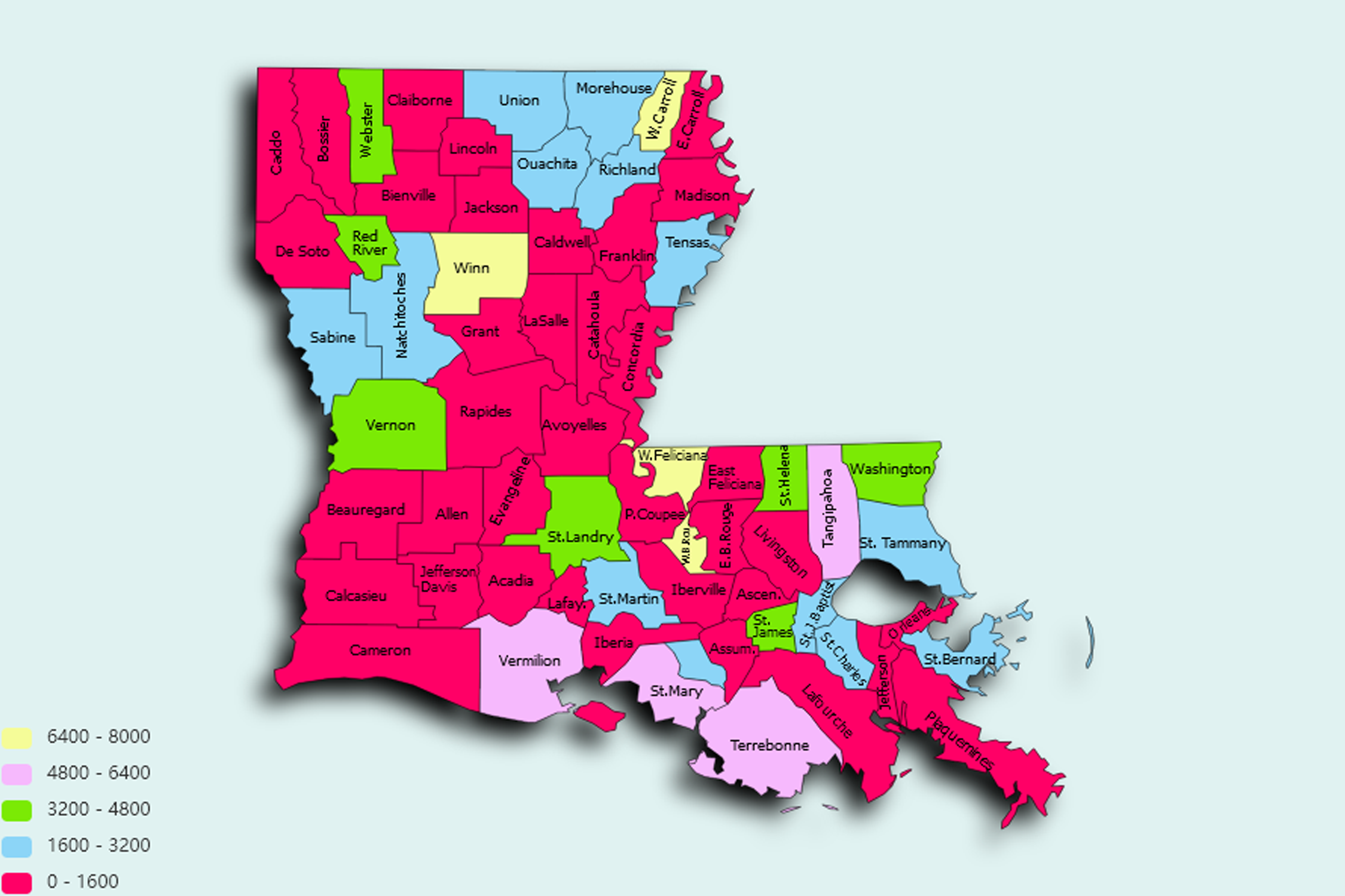
Louisiana State Statistics
About: Find out about your mental health and make a difference to everyday in your life.
![]() Population: 384320
Population: 384320
![]() Population: 228895
Population: 228895
![]() Population: 198242
Population: 198242
![]() Population: 138481
Population: 138481
![]() Population: 126066
Population: 126066
![]() Population: 74889
Population: 74889
![]() Population: 67472
Population: 67472
![]() Population: 67064
Population: 67064
![]() Population: 49601
Population: 49601
![]() Population: 48175
Population: 48175
![]() Population: 34124
Population: 34124
![]() Population: 33141
Population: 33141
![]() Population: 30745
Population: 30745
![]() Population: 29872
Population: 29872
![]() Population: 28119
Population: 28119
![]() Population: 27622
Population: 27622
![]() Population: 26895
Population: 26895
![]() Population: 23319
Population: 23319
![]() Population: 22301
Population: 22301
![]() Population: 20363
Population: 20363
![]() Population: 20348
Population: 20348
![]() Population: 20206
Population: 20206
![]() Population: 19355
Population: 19355
![]() Population: 18399
Population: 18399
![]() Population: 18384
Population: 18384
![]() Population: 17845
Population: 17845
![]() Population: 16751
Population: 16751
![]() Population: 16617
Population: 16617
![]() Population: 16377
Population: 16377
![]() Population: 16219
Population: 16219
![]() Population: 14603
Population: 14603
![]() Population: 14425
Population: 14425
![]() Population: 13776
Population: 13776
![]() Population: 13494
Population: 13494
![]() Population: 13189
Population: 13189
![]() Population: 12985
Population: 12985
![]() Population: 12808
Population: 12808
![]() Population: 12679
Population: 12679
![]() Population: 12446
Population: 12446
![]() Population: 12352
Population: 12352
![]() Population: 12236
Population: 12236
![]() Population: 12119
Population: 12119
![]() Population: 12080
Population: 12080
![]() Population: 11943
Population: 11943
![]() Population: 11926
Population: 11926
![]() Population: 11557
Population: 11557
![]() Population: 11535
Population: 11535
![]() Population: 11507
Population: 11507
![]() Population: 11193
Population: 11193
![]() Population: 11006
Population: 11006
![]() Population: 10881
Population: 10881
![]() Population: 10799
Population: 10799
![]() Population: 10580
Population: 10580
![]() Population: 10457
Population: 10457
![]() Population: 10356
Population: 10356
![]() Population: 10330
Population: 10330
![]() Population: 10243
Population: 10243
![]() Population: 10193
Population: 10193
![]() Population: 10183
Population: 10183
![]() Population: 10097
Population: 10097
![]() Population: 10015
Population: 10015
![]() Population: 9772
Population: 9772
![]() Population: 9766
Population: 9766
![]() Population: 9686
Population: 9686
![]() Population: 9334
Population: 9334
![]() Population: 9038
Population: 9038
![]() Population: 8910
Population: 8910
![]() Population: 8679
Population: 8679
![]() Population: 8545
Population: 8545
![]() Population: 8453
Population: 8453
![]() Population: 8327
Population: 8327
![]() Population: 8195
Population: 8195
![]() Population: 8122
Population: 8122
![]() Population: 8039
Population: 8039
![]() Population: 7810
Population: 7810
![]() Population: 7751
Population: 7751
![]() Population: 7723
Population: 7723
![]() Population: 7706
Population: 7706
![]() Population: 7676
Population: 7676
![]() Population: 7635
Population: 7635
![]() Population: 7400
Population: 7400
![]() Population: 7368
Population: 7368
![]() Population: 7287
Population: 7287
![]() Population: 7181
Population: 7181
![]() Population: 7104
Population: 7104
![]() Population: 7041
Population: 7041
![]() Population: 6993
Population: 6993
![]() Population: 6980
Population: 6980
![]() Population: 6963
Population: 6963
![]() Population: 6907
Population: 6907
![]() Population: 6853
Population: 6853
![]() Population: 6528
Population: 6528
![]() Population: 6261
Population: 6261
![]() Population: 6238
Population: 6238
![]() Population: 6180
Population: 6180
![]() Population: 6107
Population: 6107
![]() Population: 6092
Population: 6092
![]() Population: 5976
Population: 5976
![]() Population: 5816
Population: 5816
![]() Population: 5584
Population: 5584
![]() Population: 5553
Population: 5553
![]() Population: 5530
Population: 5530
![]() Population: 5401
Population: 5401
![]() Population: 5177
Population: 5177
![]() Population: 5172
Population: 5172
![]() Population: 5148
Population: 5148
![]() Population: 5144
Population: 5144
![]() Population: 5124
Population: 5124
![]() Population: 5006
Population: 5006
Louisiana State, constituent state of the United States of America. It is delineated from its neighbours—Arkansas to the north, Mississippi to the east, and Texas to the west—by both natural and man-made boundaries. The Gulf of Mexico lies to the south. The total area of Louisiana includes about 4,600 square miles (12,000 square km) of inland waters. The capital is Baton Rouge.

About: Find out about your mental health and make a difference to everyday in your life.