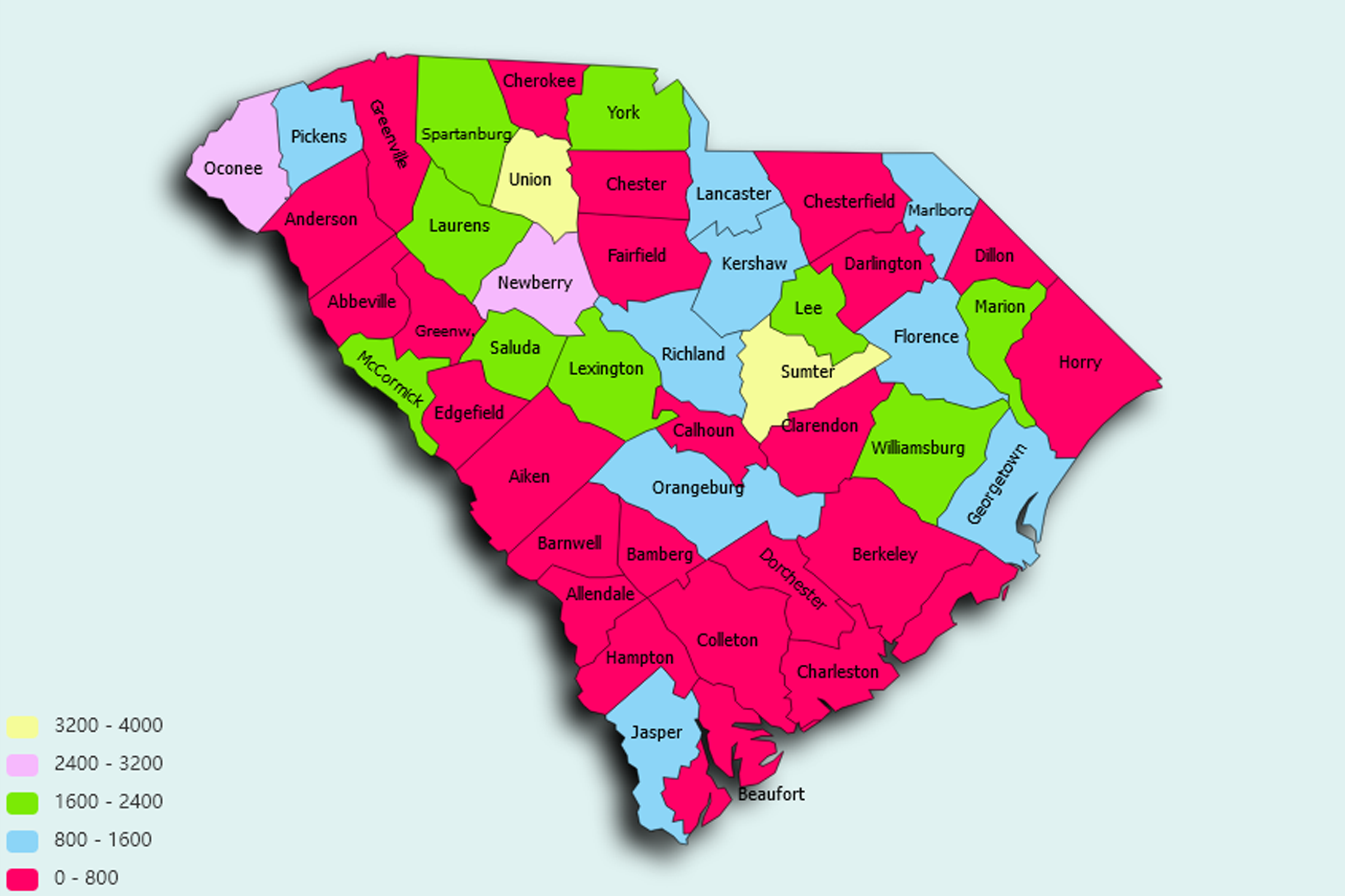
South Carolina State Statistics
About: The first tea farm in the U.S., created in 1890 near Summerville
![]() Population: 132067
Population: 132067
![]() Population: 130113
Population: 130113
![]() Population: 106749
Population: 106749
![]() Population: 77796
Population: 77796
![]() Population: 69967
Population: 69967
![]() Population: 66450
Population: 66450
![]() Population: 62252
Population: 62252
![]() Population: 49247
Population: 49247
![]() Population: 46974
Population: 46974
![]() Population: 40929
Population: 40929
![]() Population: 40370
Population: 40370
![]() Population: 40039
Population: 40039
![]() Population: 37961
Population: 37961
![]() Population: 37525
Population: 37525
![]() Population: 37514
Population: 37514
![]() Population: 30258
Population: 30258
![]() Population: 29992
Population: 29992
![]() Population: 27676
Population: 27676
![]() Population: 27181
Population: 27181
![]() Population: 24823
Population: 24823
![]() Population: 23236
Population: 23236
![]() Population: 22796
Population: 22796
![]() Population: 22300
Population: 22300
![]() Population: 21617
Population: 21617
![]() Population: 21462
Population: 21462
![]() Population: 21300
Population: 21300
![]() Population: 20622
Population: 20622
![]() Population: 20549
Population: 20549
![]() Population: 20493
Population: 20493
![]() Population: 20175
Population: 20175
![]() Population: 20125
Population: 20125
![]() Population: 19952
Population: 19952
![]() Population: 19893
Population: 19893
![]() Population: 19865
Population: 19865
![]() Population: 17927
Population: 17927
![]() Population: 15920
Population: 15920
![]() Population: 15199
Population: 15199
![]() Population: 15174
Population: 15174
![]() Population: 15144
Population: 15144
![]() Population: 15072
Population: 15072
![]() Population: 14295
Population: 14295
![]() Population: 14229
Population: 14229
![]() Population: 14140
Population: 14140
![]() Population: 14062
Population: 14062
![]() Population: 13999
Population: 13999
![]() Population: 13790
Population: 13790
![]() Population: 13553
Population: 13553
![]() Population: 13223
Population: 13223
![]() Population: 13204
Population: 13204
![]() Population: 13130
Population: 13130
![]() Population: 13087
Population: 13087
![]() Population: 13038
Population: 13038
![]() Population: 12951
Population: 12951
![]() Population: 12811
Population: 12811
![]() Population: 12597
Population: 12597
![]() Population: 12102
Population: 12102
![]() Population: 11893
Population: 11893
![]() Population: 11870
Population: 11870
![]() Population: 11431
Population: 11431
![]() Population: 10603
Population: 10603
![]() Population: 10291
Population: 10291
![]() Population: 10268
Population: 10268
![]() Population: 10205
Population: 10205
![]() Population: 9617
Population: 9617
![]() Population: 9460
Population: 9460
![]() Population: 9303
Population: 9303
![]() Population: 9286
Population: 9286
![]() Population: 9209
Population: 9209
![]() Population: 9182
Population: 9182
![]() Population: 9155
Population: 9155
![]() Population: 9120
Population: 9120
![]() Population: 9054
Population: 9054
![]() Population: 8960
Population: 8960
![]() Population: 8960
Population: 8960
![]() Population: 8841
Population: 8841
![]() Population: 8833
Population: 8833
![]() Population: 8641
Population: 8641
![]() Population: 8619
Population: 8619
![]() Population: 8468
Population: 8468
![]() Population: 8450
Population: 8450
![]() Population: 8350
Population: 8350
![]() Population: 8326
Population: 8326
![]() Population: 8246
Population: 8246
![]() Population: 8220
Population: 8220
![]() Population: 8219
Population: 8219
![]() Population: 8134
Population: 8134
![]() Population: 8041
Population: 8041
![]() Population: 8038
Population: 8038
![]() Population: 7869
Population: 7869
![]() Population: 7852
Population: 7852
![]() Population: 7639
Population: 7639
![]() Population: 7618
Population: 7618
![]() Population: 7547
Population: 7547
![]() Population: 7542
Population: 7542
![]() Population: 7434
Population: 7434
![]() Population: 7123
Population: 7123
![]() Population: 7030
Population: 7030
![]() Population: 6976
Population: 6976
![]() Population: 6803
Population: 6803
![]() Population: 6751
Population: 6751
![]() Population: 6732
Population: 6732
![]() Population: 6668
Population: 6668
![]() Population: 6658
Population: 6658
![]() Population: 6586
Population: 6586
![]() Population: 6304
Population: 6304
![]() Population: 6299
Population: 6299
![]() Population: 6296
Population: 6296
![]() Population: 6206
Population: 6206
![]() Population: 6123
Population: 6123
![]() Population: 5944
Population: 5944
![]() Population: 5891
Population: 5891
![]() Population: 5891
Population: 5891
![]() Population: 5867
Population: 5867
![]() Population: 5804
Population: 5804
![]() Population: 5793
Population: 5793
![]() Population: 5792
Population: 5792
![]() Population: 5628
Population: 5628
![]() Population: 5579
Population: 5579
![]() Population: 5494
Population: 5494
![]() Population: 5484
Population: 5484
![]() Population: 5423
Population: 5423
![]() Population: 5377
Population: 5377
![]() Population: 5287
Population: 5287
![]() Population: 5281
Population: 5281
![]() Population: 5191
Population: 5191
![]() Population: 5149
Population: 5149
![]() Population: 5123
Population: 5123
![]() Population: 5103
Population: 5103
![]() Population: 5047
Population: 5047
South Carolina State, constituent state of the United States of America, one of the 13 original colonies. It lies on the southern Eastern Seaboard of the United States. Shaped like an inverted triangle with an east-west base of 285 miles (459 km) and a north-south extent of about 225 miles (360 km), the state is bounded on the north by North Carolina, on the southeast by the Atlantic Ocean, and on the southwest by Georgia. Columbia, located in the centre of the state, is the capital and largest city.

About: The first tea farm in the U.S., created in 1890 near Summerville