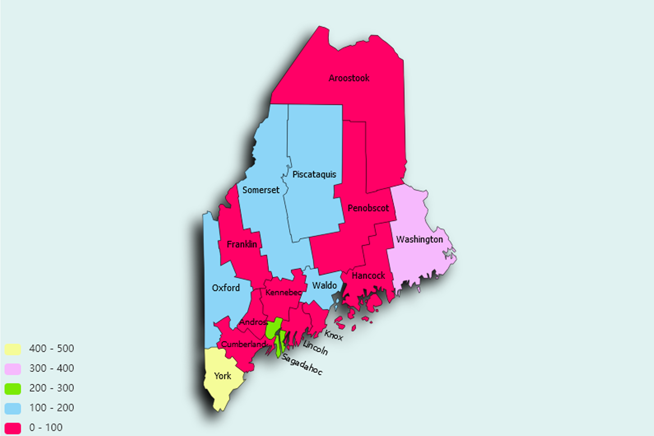
Maine State Statistics
About: Find out about your mental health and make a difference to everyday in your life.
![]() Population: 66666
Population: 66666
![]() Population: 36299
Population: 36299
![]() Population: 32568
Population: 32568
![]() Population: 25424
Population: 25424
![]() Population: 22912
Population: 22912
![]() Population: 21337
Population: 21337
![]() Population: 20906
Population: 20906
![]() Population: 19014
Population: 19014
![]() Population: 18705
Population: 18705
![]() Population: 17886
Population: 17886
![]() Population: 17001
Population: 17001
![]() Population: 16182
Population: 16182
![]() Population: 15175
Population: 15175
![]() Population: 12529
Population: 12529
![]() Population: 11185
Population: 11185
![]() Population: 9874
Population: 9874
![]() Population: 9589
Population: 9589
![]() Population: 9474
Population: 9474
![]() Population: 9317
Population: 9317
![]() Population: 9317
Population: 9317
![]() Population: 9015
Population: 9015
![]() Population: 9009
Population: 9009
![]() Population: 8624
Population: 8624
![]() Population: 8324
Population: 8324
![]() Population: 8034
Population: 8034
![]() Population: 7871
Population: 7871
![]() Population: 7843
Population: 7843
![]() Population: 7794
Population: 7794
![]() Population: 7761
Population: 7761
![]() Population: 7693
Population: 7693
![]() Population: 7693
Population: 7693
![]() Population: 7220
Population: 7220
![]() Population: 7219
Population: 7219
![]() Population: 7211
Population: 7211
![]() Population: 6882
Population: 6882
![]() Population: 6677
Population: 6677
![]() Population: 6297
Population: 6297
![]() Population: 6204
Population: 6204
![]() Population: 6031
Population: 6031
![]() Population: 5931
Population: 5931
![]() Population: 5869
Population: 5869
![]() Population: 5734
Population: 5734
![]() Population: 5675
Population: 5675
![]() Population: 5542
Population: 5542
![]() Population: 5416
Population: 5416
![]() Population: 5376
Population: 5376
![]() Population: 5214
Population: 5214
![]() Population: 5183
Population: 5183
Maine State, constituent state of the United States of America. The largest of the six New England states in area, it lies at the northeastern corner of the country. Its total area, including about 2,300 square miles (6,000 square km) of inland water, represents nearly half of the total area of New England. Maine is bounded to the northwest and northeast by the Canadian provinces of Quebec and New Brunswick, respectively, and to the west by New Hampshire.

About: Find out about your mental health and make a difference to everyday in your life.