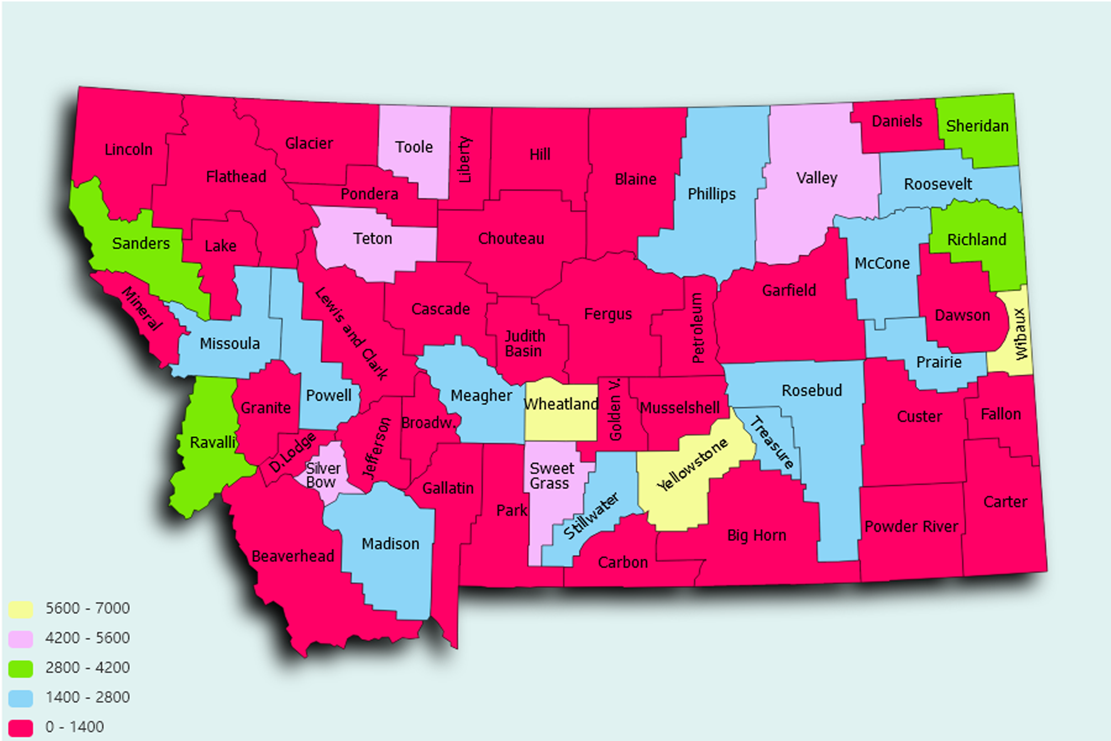
Montana State Statistics
About: Find out about your mental health and make a difference to everyday in your life.
![]() Population: 108869
Population: 108869
![]() Population: 69821
Population: 69821
![]() Population: 59152
Population: 59152
![]() Population: 41660
Population: 41660
![]() Population: 33980
Population: 33980
![]() Population: 31633
Population: 31633
![]() Population: 29943
Population: 29943
![]() Population: 21518
Population: 21518
![]() Population: 12251
Population: 12251
![]() Population: 9792
Population: 9792
![]() Population: 9319
Population: 9319
![]() Population: 9150
Population: 9150
![]() Population: 8758
Population: 8758
![]() Population: 8227
Population: 8227
![]() Population: 7883
Population: 7883
![]() Population: 7798
Population: 7798
![]() Population: 7757
Population: 7757
![]() Population: 7626
Population: 7626
![]() Population: 7616
Population: 7616
![]() Population: 7245
Population: 7245
![]() Population: 6936
Population: 6936
![]() Population: 6864
Population: 6864
![]() Population: 6826
Population: 6826
![]() Population: 6797
Population: 6797
![]() Population: 6674
Population: 6674
![]() Population: 6473
Population: 6473
![]() Population: 5867
Population: 5867
![]() Population: 5399
Population: 5399
![]() Population: 5197
Population: 5197
![]() Population: 5181
Population: 5181
Montana State, constituent state of the United States of America. Only three states—Alaska, Texas, and California—have an area larger than Montana’s, and only two states—Alaska and Wyoming—have a lower population density. Montana borders the Canadian provinces of British Columbia, Alberta, and Saskatchewan to the north and the U.S. states of North Dakota and South Dakota to the east, Wyoming to the south, and Idaho to the west. Although its name is derived from the Spanish montaña (“mountain” or “mountainous region”), Montana has an average elevation of only 3,400 feet (1,040 metres), the lowest among the Mountain states. The Rocky Mountains sweep down from British Columbia, trending northwest-southeast into western Montana, Idaho, and Wyoming.

About: Find out about your mental health and make a difference to everyday in your life.