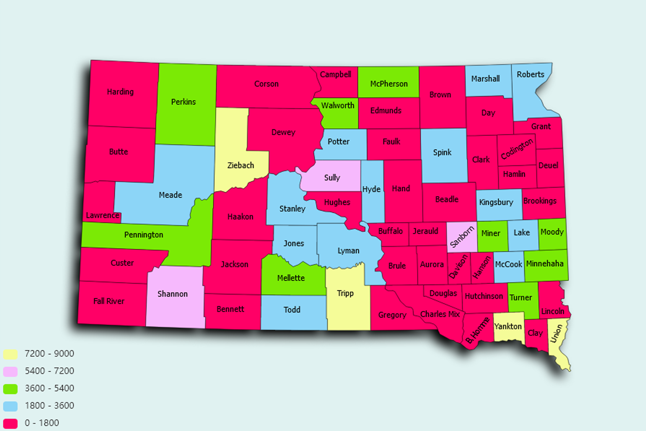
South Dakota State Statistics
About: The world's largest natural, indoor warmwater pool, Evans' Plunge in Hot Springs
![]() Population: 168586
Population: 168586
![]() Population: 72638
Population: 72638
![]() Population: 27800
Population: 27800
![]() Population: 23225
Population: 23225
![]() Population: 22057
Population: 22057
![]() Population: 15693
Population: 15693
![]() Population: 14552
Population: 14552
![]() Population: 14054
Population: 14054
![]() Population: 13163
Population: 13163
![]() Population: 11091
Population: 11091
![]() Population: 10699
Population: 10699
![]() Population: 9779
Population: 9779
![]() Population: 9233
Population: 9233
![]() Population: 8260
Population: 8260
![]() Population: 7126
Population: 7126
![]() Population: 6741
Population: 6741
![]() Population: 5707
Population: 5707
![]() Population: 5190
Population: 5190
South Dakota State, constituent state of the United States of America. South Dakota became the 40th state of the union on November 2, 1889. The state has two unique physical features: it contains the geographic centre of the United States, which is located just north of Belle Fourche, and it has its own continental divide, as a result of which Lake Traverse, in the southeastern corner of the state, flows northward to Hudson Bay, and Big Stone Lake, on the Minnesota border, flows southward to the Gulf of Mexico. South Dakota is bordered by North Dakota to the north, Minnesota and Iowa to the east, Nebraska to the south, and Wyoming and Montana to the west. The state is split by the upper Missouri River valley into eastern and western regions. Pierre, in central South Dakota, is one of the country’s smallest state capitals.

About: The world's largest natural, indoor warmwater pool, Evans' Plunge in Hot Springs