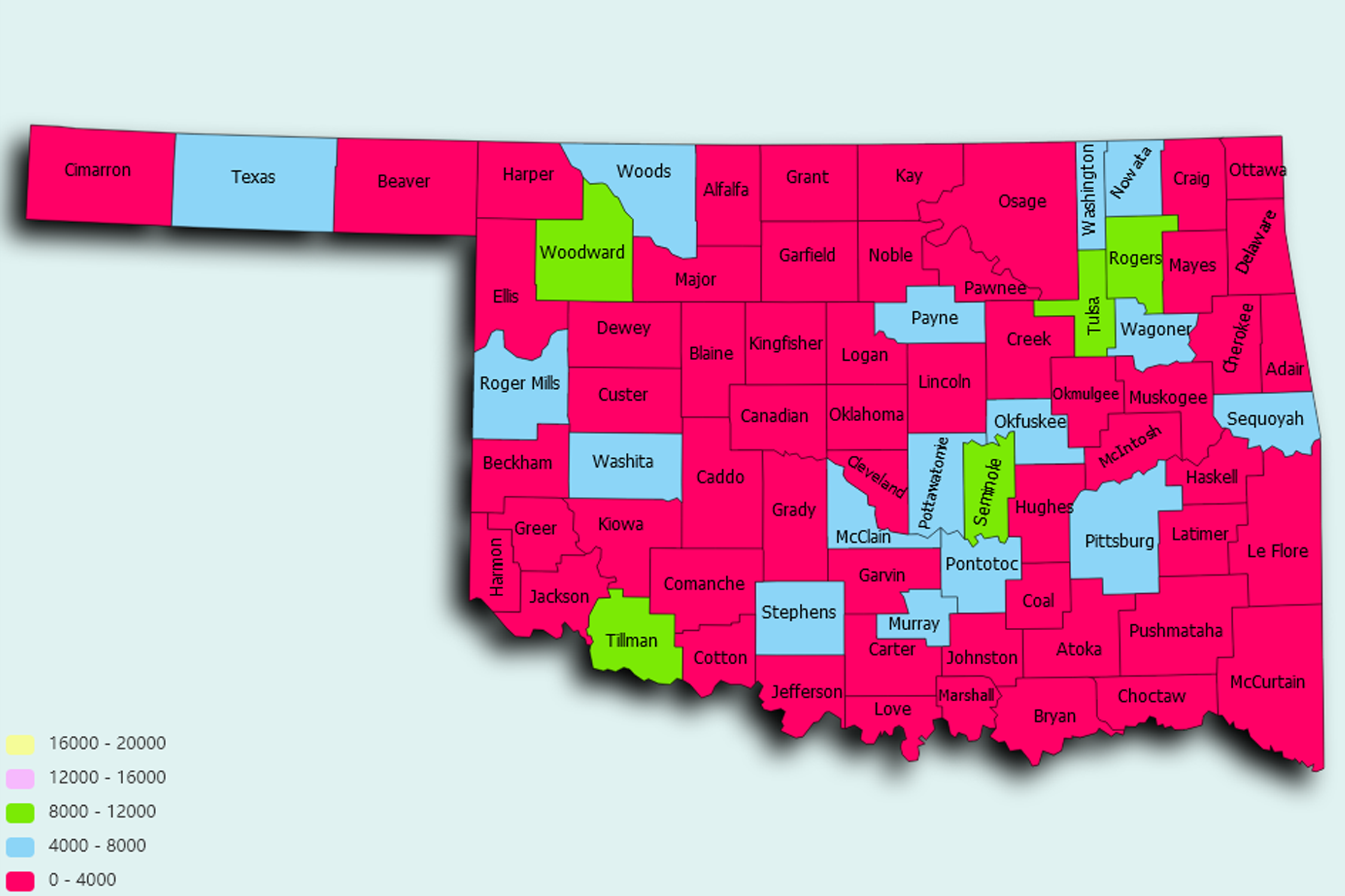
Oklahoma State Statistics
About: he first parking meter, installed in Oklahoma City in 1935
![]() Population: 620602
Population: 620602
![]() Population: 399682
Population: 399682
![]() Population: 118040
Population: 118040
![]() Population: 104726
Population: 104726
![]() Population: 102211
Population: 102211
![]() Population: 97017
Population: 97017
![]() Population: 88605
Population: 88605
![]() Population: 72697
Population: 72697
![]() Population: 59196
Population: 59196
![]() Population: 57039
Population: 57039
![]() Population: 51386
Population: 51386
![]() Population: 48406
Population: 48406
![]() Population: 38616
Population: 38616
![]() Population: 36498
Population: 36498
![]() Population: 33773
Population: 33773
![]() Population: 31254
Population: 31254
![]() Population: 25349
Population: 25349
![]() Population: 25226
Population: 25226
![]() Population: 24766
Population: 24766
![]() Population: 24008
Population: 24008
![]() Population: 23792
Population: 23792
![]() Population: 23173
Population: 23173
![]() Population: 22008
Population: 22008
![]() Population: 20850
Population: 20850
![]() Population: 20432
Population: 20432
![]() Population: 19951
Population: 19951
![]() Population: 19638
Population: 19638
![]() Population: 19580
Population: 19580
![]() Population: 19553
Population: 19553
![]() Population: 19531
Population: 19531
![]() Population: 18971
Population: 18971
![]() Population: 18247
Population: 18247
![]() Population: 18153
Population: 18153
![]() Population: 17377
Population: 17377
![]() Population: 17130
Population: 17130
![]() Population: 17041
Population: 17041
![]() Population: 16496
Population: 16496
![]() Population: 16334
Population: 16334
![]() Population: 14220
Population: 14220
![]() Population: 13671
Population: 13671
![]() Population: 12963
Population: 12963
![]() Population: 12680
Population: 12680
![]() Population: 12227
Population: 12227
![]() Population: 12128
Population: 12128
![]() Population: 12014
Population: 12014
![]() Population: 11992
Population: 11992
![]() Population: 11989
Population: 11989
![]() Population: 11855
Population: 11855
![]() Population: 11275
Population: 11275
![]() Population: 11096
Population: 11096
![]() Population: 10669
Population: 10669
![]() Population: 10408
Population: 10408
![]() Population: 9511
Population: 9511
![]() Population: 9505
Population: 9505
![]() Population: 9445
Population: 9445
![]() Population: 9324
Population: 9324
![]() Population: 9155
Population: 9155
![]() Population: 8691
Population: 8691
![]() Population: 8665
Population: 8665
![]() Population: 8650
Population: 8650
![]() Population: 8612
Population: 8612
![]() Population: 8598
Population: 8598
![]() Population: 8211
Population: 8211
![]() Population: 8107
Population: 8107
![]() Population: 8049
Population: 8049
![]() Population: 7868
Population: 7868
![]() Population: 7788
Population: 7788
![]() Population: 7638
Population: 7638
![]() Population: 7486
Population: 7486
![]() Population: 7157
Population: 7157
![]() Population: 7114
Population: 7114
![]() Population: 7010
Population: 7010
![]() Population: 6917
Population: 6917
![]() Population: 6734
Population: 6734
![]() Population: 6723
Population: 6723
![]() Population: 6717
Population: 6717
![]() Population: 6698
Population: 6698
![]() Population: 6631
Population: 6631
![]() Population: 6583
Population: 6583
![]() Population: 6542
Population: 6542
![]() Population: 6340
Population: 6340
![]() Population: 6334
Population: 6334
![]() Population: 6079
Population: 6079
![]() Population: 6070
Population: 6070
![]() Population: 6023
Population: 6023
![]() Population: 5946
Population: 5946
![]() Population: 5780
Population: 5780
![]() Population: 5759
Population: 5759
![]() Population: 5724
Population: 5724
![]() Population: 5554
Population: 5554
![]() Population: 5546
Population: 5546
![]() Population: 5287
Population: 5287
![]() Population: 5211
Population: 5211
![]() Population: 5174
Population: 5174
![]() Population: 5116
Population: 5116
![]() Population: 5115
Population: 5115
![]() Population: 5111
Population: 5111
![]() Population: 5075
Population: 5075
![]() Population: 5052
Population: 5052
![]() Population: 5041
Population: 5041
Oklahoma State, constituent state of the United States of America. It borders Colorado and Kansas to the north, Missouri and Arkansas to the east, Texas to the south and west, and New Mexico to the west of its Panhandle region. In its land and its people, Oklahoma is a state of contrast and of the unexpected. The terrain varies from the rolling, timbered hills of the east to the treeless high plains that extend from the Panhandle region into Texas and New Mexico.

About: he first parking meter, installed in Oklahoma City in 1935